
Laguna Capri Hike El Chalten: Distance, Climb and Turnaround Choices
Plan the Laguna Capri hike in El Chalten using the park's route reference. Check one-way distance, town approach, lake stops and a realistic return.
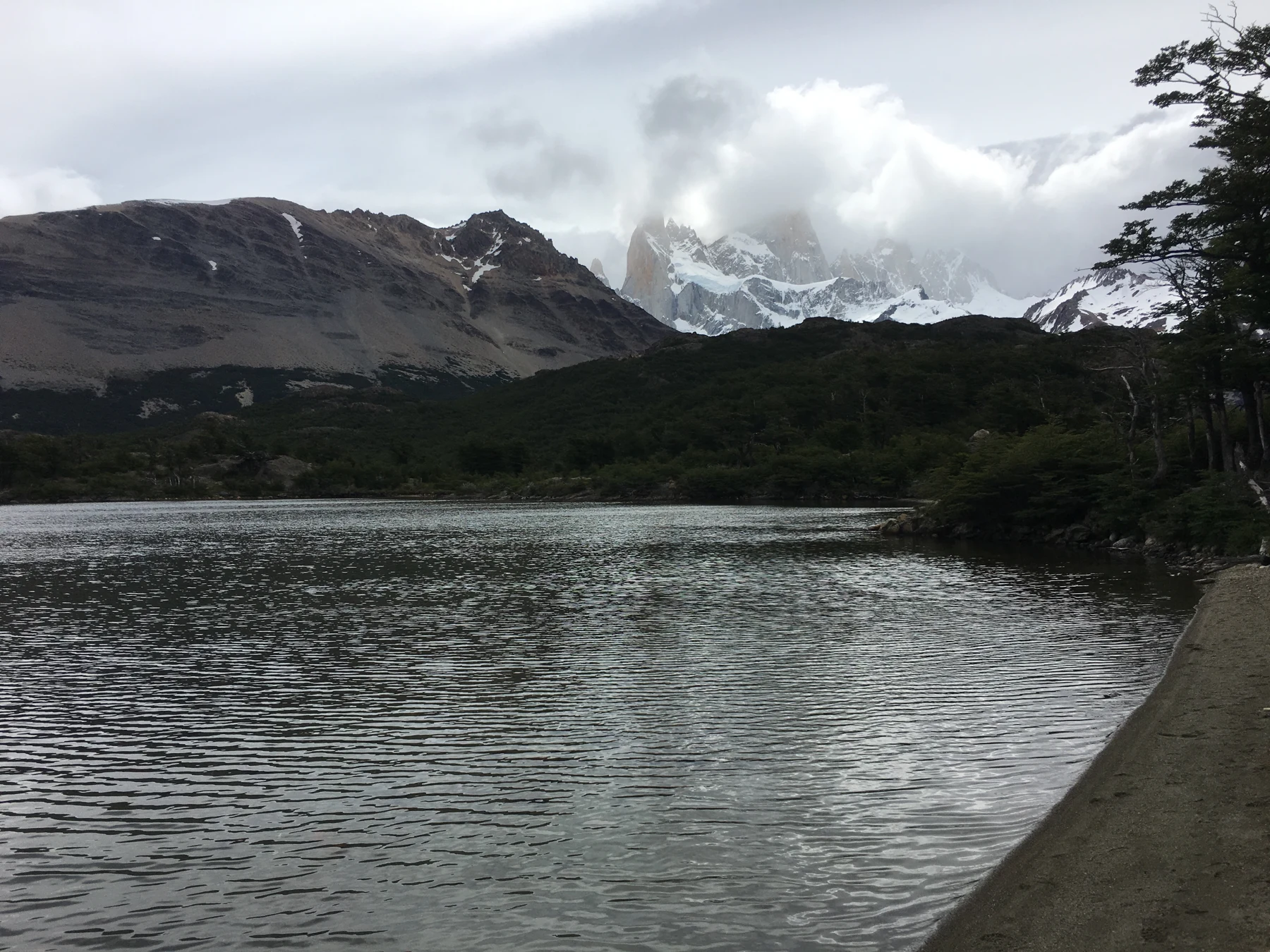
Laguna Capri 2015.JPG by Fredlyfish4, CC BY-SA 4.0. Resized and converted to WebP.

The Laguna Capri hike in El Chalten is a shorter Fitz Roy-area outing than continuing to Laguna de los Tres. It reaches a lake and returns to town without the longer route's final ascent. Use the real trail start when comparing distance. Leave room to turn back if conditions do not fit the day.
Choose Laguna Capri when you want a lake-and-mountain walking day without committing to the full Laguna de los Tres route. APN's northern trail brochure lists four kilometres one way from the trail start, with a listed height difference of 350 metres. Treat the park's walking time as a planning estimate. Check current access and return by the allowed route.
Trailhead and route overview
APN's northern trail brochure maps Laguna Capri on the Fitz Roy walking network. It also shows the separate approach from the visitor centre to the trail start. Keep that approach separate from the distance listed for the mountain trail.
The map locates the northern approach by the town streets and the route into the Fitz Roy area. Use the current park signs at the start rather than treating this guide as turn-by-turn navigation. Check the condition with the park before leaving town.
Choose the trail from the El Chalten planning guide when deciding what fits your stay. The lake is a chosen walking purpose. It is not a promise that the mountain behind it will be visible throughout your visit.
Laguna Capri hike in El Chalten: distance and height
The brochure's trail table gives Laguna Capri four kilometres one way. Returning along the matching route gives about eight kilometres on the mountain trail, before any extra town approach. That return total is arithmetic from the listed one-way figure, not a new GPS measurement.
| Park brochure field | Listed reference | How to use it |
|---|---|---|
| Distance | Four kilometres one way | Add the return and any town approach |
| Listed vertical difference | 350 metres | Not a complete detailed elevation profile |
| Walking duration | One hour 45 minutes one way | A park estimate, not your guaranteed pace |
| Trail purpose | Lake view in the Fitz Roy area | Visibility still depends on conditions |
Scroll for more →
These figures were checked October 2026 in the park's brochure. They describe that mapped trail reference. They do not apply unchanged to every hotel start, detour or combination with another viewpoint.
The park's general web outing page gives a different Capri distance that does not agree with the brochure's trail table. We use the route-specific brochure figure and keep the start point explicit. If the signs or park advice give a revised route, follow that current details instead.
Walking stages and turnaround options
Keep the lake and the Fitz Roy lookout distinct
The park map labels Laguna Capri and the Fitz Roy viewpoint separately. Its table gives both a listed one-way distance from the trail reference. That does not mean you should add the two totals to describe a combined walk: part of the approach belongs to the same wider network.
If you want both stops, read their linking paths on the official map and check the current signs. Choose the return branch deliberately. A leaflet's distance to one area is not a total for every possible combination. This is especially useful when a guided seller names both places in one outing.
Read the day as a town approach, the mountain trail, the lake stop and the return. A pause at the lake can be the purpose of the outing rather than an interruption to a longer trek. Choose how long to stay from the conditions and the time needed to return.
The broader Fitz Roy network has branches and onward choices. Do not let reaching a junction turn the day into an unplanned longer route. Choose the Capri purpose before starting and read any extra branch as extra walking.
If the mountain view is hidden, the lake walk still has its own setting. Decide whether it fits your purpose under those conditions. Waiting for cloud to lift does not remove the return task or create extra daylight.
Set a conservative turnaround if the route is slower than expected. The lake need not be reached at all costs. A park estimate is useful for comparing outings. But the real surface, weather and party pace govern your day.
Conditions and access checks
APN's brochure warns that town conditions can differ from conditions in the mountains. Check the present trail advice. A pleasant morning in El Chalten is not enough to prove what the upper route will be like.
The park tells visitors to walk on marked trails and plan to be back before night. Use the real route rule at the start. Keep your return realistic instead of relying on a broad all-year description from an older tourism page.
APN's current visitor material distinguishes ordinary outings from remote-area trekking and publishes registration rules. Ask the park which rule applies to your date and route. A mapped camping symbol does not prove that an overnight plan is allowed without further checks.
If you buy a guided outing, confirm the real route and leader. A guide service for a longer Fitz Roy hike is not always the same product as a Capri day. Ask where the walk starts and ends and how the guide handles a changed plan.
Capri versus the longer Fitz Roy hike
Laguna Capri and Laguna de los Tres belong to the same wider walking area. But they represent different commitments. The park table lists a longer distance and higher vertical difference for Laguna de los Tres. Its final ascent changes the walking task.
Our Laguna de los Tres guide helps compare that full day. Choose it because you want the longer route and it fits conditions, rather than because it appears as an onward option while you are already walking.
Capri can suit a day with less available time, subject to the real approach and pace. It can also suit a visitor who wants the lake view without the longer route's final climb. It is still a mountain walk, so a shorter label should not be confused with an effortless outing.
Keep the choice separate from lodging and food. A shorter trail can leave more time in town. But a late arrival or long breakfast can still reduce the usable day. Count your real time from the place you start.
Choose the broader walking plan
Use the El Chalten hike comparison to place Capri among the shorter and longer day choices.
A useful day checklist
Before leaving town: check the current trail rule and your real start. Read the forecast for the mountain outing. Make the route purpose clear to everyone travelling with you.
At the trail start: read the local signs and note the allowed route. Keep the park's estimate separate from your own pace. Agree on how the group will stay together and where it would turn back.
At the lake: choose the pause from the weather and the return. Do not extend the day merely because another route appears nearby. A clear view is welcome, but it is not promised by the route plan.
On return: use the designated trail and the town plan you booked. If a guide or vehicle is involved, keep its meeting rules. The lake stop and the end of the walking day are different points in the plan.
Questions before the Capri walk
Is Laguna Capri the same hike as Laguna de los Tres?
No. They are different places within the Fitz Roy walking network. Capri is the shorter lake outing; Laguna de los Tres adds a longer route and final ascent. Choose the whole day before starting, with the return included. Do not treat an onward branch as an automatic upgrade once you reach it.
How far is the Laguna Capri walk?
APN's northern brochure lists four kilometres one way from the trail start. An out-and-back on that reference gives about eight kilometres, plus any extra approach through town. Use the real start point when comparing totals and follow a revised park rule if conditions or the designated route change.
Does the park's time estimate guarantee my walking time?
No. It is a reference for the mapped route. Your pace, stops and conditions can differ.
Add the return and the town approach separately, then leave room to turn back. The estimate is useful for comparing walks. But it should not become a deadline that makes you rush an unsuitable route.
Can I count on seeing Fitz Roy from the lake?
No. The route offers that view when conditions allow, but cloud can hide the mountain. Choose the outing for the walk and lake setting as well. Keep the return tied to time and access rather than waiting indefinitely for visibility. A photo shows one moment, not the conditions on your day.
Sources and facts last checked
Checked October 2026: APN's 2024 northern trail brochure and current Los Glaciares visitor details. Distances refer to the brochure's start points. The map is an orientation source, not a live condition report.
Verdict on the Laguna Capri hike in El Chalten
Choose the Laguna Capri hike in El Chalten for its shorter lake-focused day. Keep the trail start and return visible in the distance calculation. Continue farther only through a new plan that fits the present conditions and time available.